

Potato Chip Rock (Mount Woodson) is one of the most infamous hikes and photography spots in San Diego. Crowded trails and a long line to take that memorable photo on top of the Potato Chip Rock, seemingly hanging on the edge of the earth. Now you know I love to share hidden gems, so why would I be SO excited (I’m giddy, seriously) to blog about this very overpopulated and well known hike? Well, it’s because I just discovered a new trail to the Potato Chip Rock…one that is drop dead gorgeous the entire way, challenging but less painful than the other trails, and relatively unknown and therefore NOT CROWDED!!!! YES, it’s true. Read on my friends for the details of one of the most gorgeous, scenic, and enjoyable hikes in all of San Diego!
About the Potato Chip Rock Trail (via Fry-Koegel Trail)
This 7-mile back and out trail is an incredible workout (I’m still sore several days later) and it doesn’t even seem that long because it’s just gorgeous the entire way…greenery, wildflowers, artistically and naturally existing boulders and rock formations, and of course, sweeping views as you head up the mountain. That’s what makes this trail special compared to the 2 very well-known alternatives:
- Lake Poway – This route is popular, long, and extremely steep in some places (it just keeps going up and up) without much scenery to distract.
- Ramona – 67 – This route is shorter than both, but straight up, and is along a dirt road so it just feels like you are climbing a road and not really hiking. Meh.
Details on how to get there are at the end of the post, but know that the trail head is not marked, and you climb through this hole in the barbed wire fence! Yes, you are going the right way! Once you get through the barbed wire fence, you’ll see a trail with a wooden fence. Climb through the wooden fence pillar and turn left to head up the mountain.

We went on a Friday morning, these 5 fearless Moms including me, while the kiddos were in school and the husbands were working!

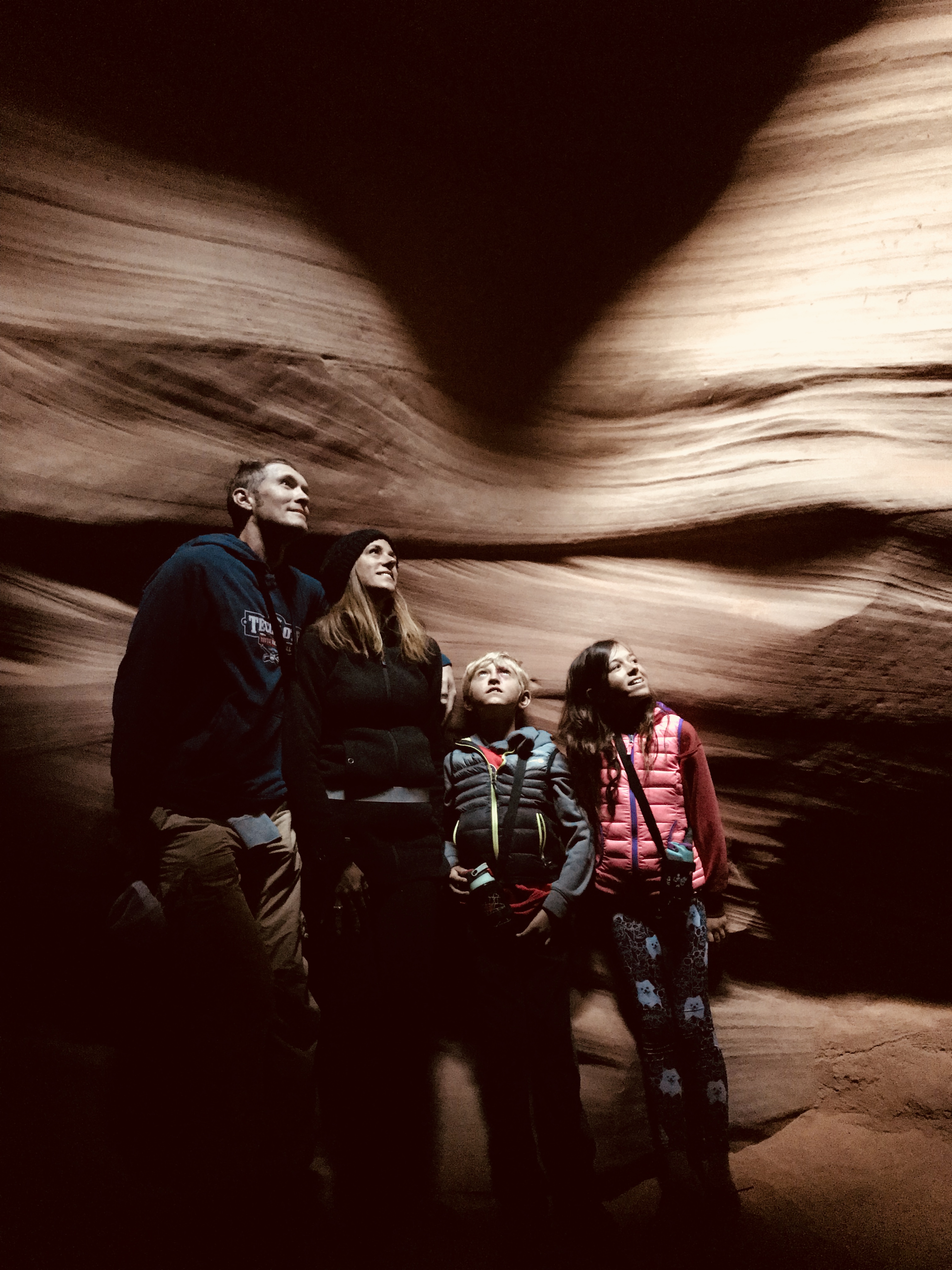
Exploring the Trail to Potato Chip Rock
The beginning of the trail winds you through the back of some pretty amazing houses. Eventually you’ll come to more forest-like surroundings until you start climbing upwards…and then…the views begin. We went on a cloudy day so it’s even more spectacular when the sun is shining.

How stunning is this? The trail is well maintained and keeps winding around panoramic views and fantastic boulders and ledges to take a break when needed.

You’ll cross a few forks in the road. Follow the signs to Mount Woodson Summit, where you’ll eventually break off from the Fry-Koegel Trail for the last mile or so.

Arriving at Potato Chip Rock
For the first time ever when hiking to Potato Chip Rock, while I was certainly tired, when the rock appeared I was pleasantly surprised (versus the other trails when I finally arrived I was feeling massive relief). If you go early (do yourself a favor) the line to stand on the rock and take photos won’t be too long. The rock looks sketchy, but it is very stable, although the surface is uneven and you do need to be careful…if you aren’t paying attention, you could fall!

This is the part where you make friends and help each other out to take photos! Now, a bit of warning…getting onto Potato Chip Rock is probably the toughest feat of the day. It requires you to scale down a boulder and there is a big gap which caused several of us some anxiety and second guessing our desires to get on the rock. In the past there was a ladder to help cross over, but this time the ladder was not there. A few of us went back down and scaled up the rock which seemed a bit easier than crossing over the big gap. You’ll see. If you are afraid of heights this may not be for you…but I definitely encourage you to go for it. You’ve worked so hard to get to this point, take the photo! As you can see, these are both awesome angles which would be even better if it wasn’t a cloudy day.


OH! And flashback from a couple of years ago when the husband and I did a “date day” climbing Potato Chip Rock. We get on the rock steadily to take a photo and what does he do? Yup, swoops me up unexpectedly! The roars from the crowd watching us were deafening, but we were all smiles. I asked him why he didn’t tell me he wanted to do that? He said, “you’d never let me!” Truth.

Back Down the Trail
You did it! Whew! Back to safety and solid ground. Enjoy the beauty surrounding you as you head back to where it all began. We noticed so many different plants and wildflowers on the way down that we didn’t notice as we were heading up.


Know Before You Go – Potato Chip Rock (Mount Woodson) via Fry-Koegel Trail

Ok, let’s talk logistics so you are fully prepared to take this secret trail to Potato Chip Rock!
When to go: While this trail to get there isn’t crowded, the 3 trails connect at the top when you get to Potato Chip Rock and that will be very crowded. Your best bet is to go 1) On a weekday and 2) Early! Aim to start before 9 a.m., even earlier if it’s a weekend. Wait times at the Rock can be over an hour on the weekend in the middle of the day. You also want to go early to avoid the heat, as it can get very hot and the majority of the trail is not shaded.
Time to allow: 5 Moms took 3 hours to do it, which included time at Potato Chip Rock.
Kids? It’s a tough trail. If you have older kids (I’d say at least age 10+ or if you are super strong and can carry a young one in a hiking pack) who are athletic and have good endurance, they could probably do it. Younger children would have a difficult time getting up there. Use cautioun with the actual Potato Chip Rock – it truly is a ledge, and getting kids to it could prove difficult.
What to bring: A lot of water, snacks, sunscreen, hat. Hiking shoes are helpful as going down can be a bit slippery if you have shoes with poor traction. There aren’t many bugs or wildlife to be seen on the trail. Cameras or your cell phone to take photos is a must!
Getting there: The trailhead is about 45 minutes or so from downtown San Diego. From CA-163N, merge onto I-15N, then east onto Scripps Poway Pkwy. Turn left/north on SR-67. Drive past the Cal Fire Ramona Station at 16310 SR-67 (3 miles past the junction of Poway Rd. and SR-67) until you can safely turn around to park on the SR-67 shoulder near the fire station on the Mt. Woodson side of the highway heading west.
Parking / Facilities: You’ll see many cars parked along the 67 and that’s how you’ll know you are there. However, those cars are parked near the trailhead that is very popular (and just a boring dirt road straight up!). Park there…but then walk East crossing a small road, and towards the guardrail. You’ll see a little dirt path that goes down behind the guard rail. That unmarked path (that doesn’t even look like a path) is the way to go….and as you head down you’ll see the barbed wire fence that’s been pushed open. Wallah! There are no facilities at the trailhead or on the trail. Make sure you take care of business before you go!
We hope you enjoy this amazing adventure! Tell us what you think, we are listening!


&media=https://i0.wp.com/sdfamilytravelers.com/wp-content/uploads/2018/05/Potato-Chip-Rock-20.jpg?fit=775%2C579&ssl=1)
2 comments
Great site. Happy I found you.
Retired from Lockheed.
Just move to San Diego from Texas. Looking forward to hiking.
Hi Laura!
Sorry for my late reply – I was *just* notified of your comment! I hope you are enjoying San Diego and have found some great hikes! Any great ones to share?